Archive for the ‘Summer Recreation’ Category
3By Tim Hauserman
While many of the higher elevation trails around Tahoe and Truckee are still covered in snow, this mild winter has made it possible to hike a few lower elevation trails that you rarely encounter snow free before May, let alone March:
Negro Canyon and the Donner Lake Rim Trail

Photo by Tim Hauserman
A few miles east of Truckee, just off I-80 at the Donner Lake Exit, you will find the Wendin Way Access Trail to the Donner Lake Rim Trail. The snow melts fast off this sun baked south facing bowl, and the well graded trail is a pleasure to hike. After a mile, you join the Donner Lake Rim Trail, where you find another mile of steeper climbing to the Tahoe Donner Cross-Country Ski Area’s Drifter hut at the top of the ridge. If you’ve skied to Drifter before, you will find this hike a piece of cake in comparison, and yet you still get awesome views of the snow covered Sierra crest.
.
Vikingsholm

Photo by Tim Hauserman
Now, when crowds are absent, is the time to enjoy Lake Tahoe’s most popular hiking trail to the Vikingsholm mansion in Emerald Bay. Take the one mile descent to the waters edge, then follow the south facing shoreline on the Rubicon Trail to the entrance of the bay, and then along Tahoe’s west shore towards Bliss State Park. A sit at the end of the Boat Campground pier, with it’s views of Maggies Peaks and Eagle Falls, makes for a nice break.
Tahoe Rim Trail-North from Tahoe City.
From the trailhead along Fairway Drive in Tahoe City, the Tahoe Rim Trail climbs through cedar and fir while dishing out views of Lake Tahoe and Tahoe City. In about a mile, a wide panorama of the lake opens up, as well as views of the Truckee River Canyon. If you have more time and energy, keep walking, as you pass nearly constant views of the Truckee River and Lake Tahoe.
.
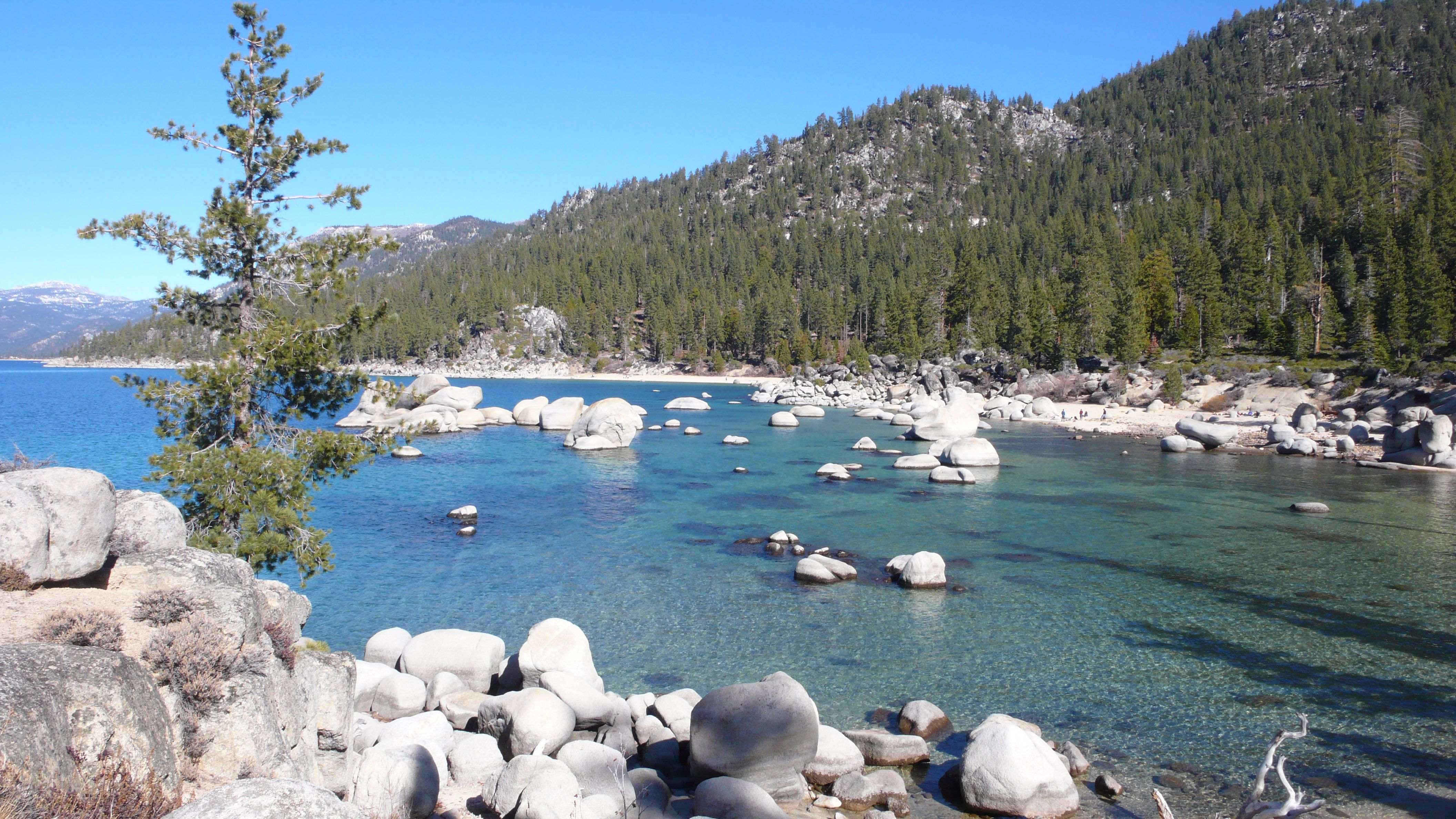
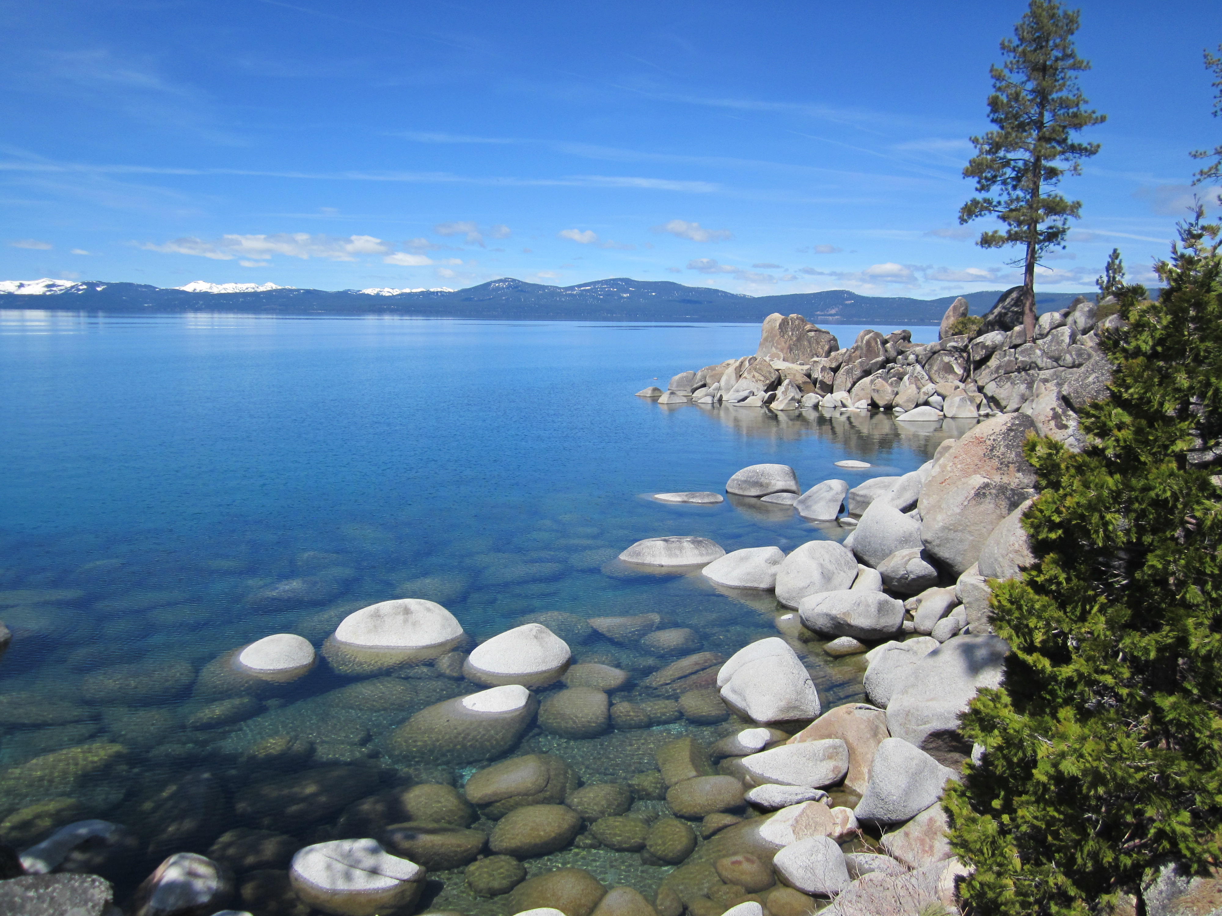
East shore beaches
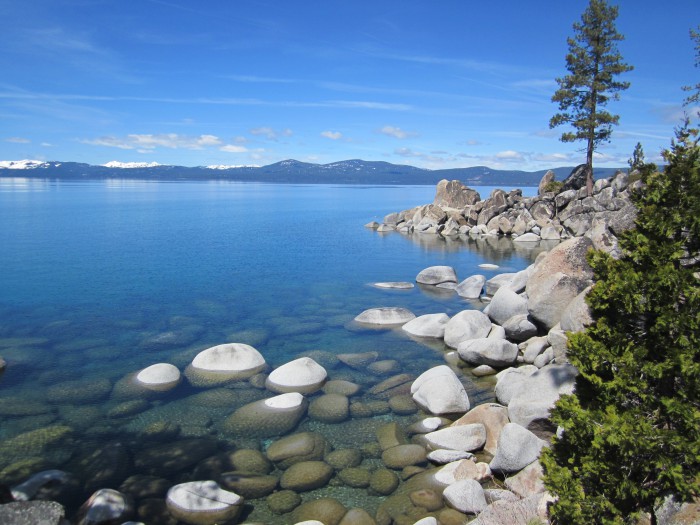
Photo by Michelle Portesi
While skinny dipping in March might not be on your list of things to do, perhaps enjoying the lovely beaches of the east shore with clothes on, but crowds gone, sounds attractive. Several short trails lead from Highway 28 down to the lovely, rocky shore of Lake Tahoe. Wander past all the tidy little coves and pick your perfect little secluded beach to ponder the beauty of Tahoe.
THINK OF ME, LYNN RICHARDSON, FOR ALL OF YOUR LAKE TAHOE AND TRUCKEE REAL ESTATE NEEDS!
Share this: Lynn Richardson, Your Friend in High Places
By Tim Hauserman
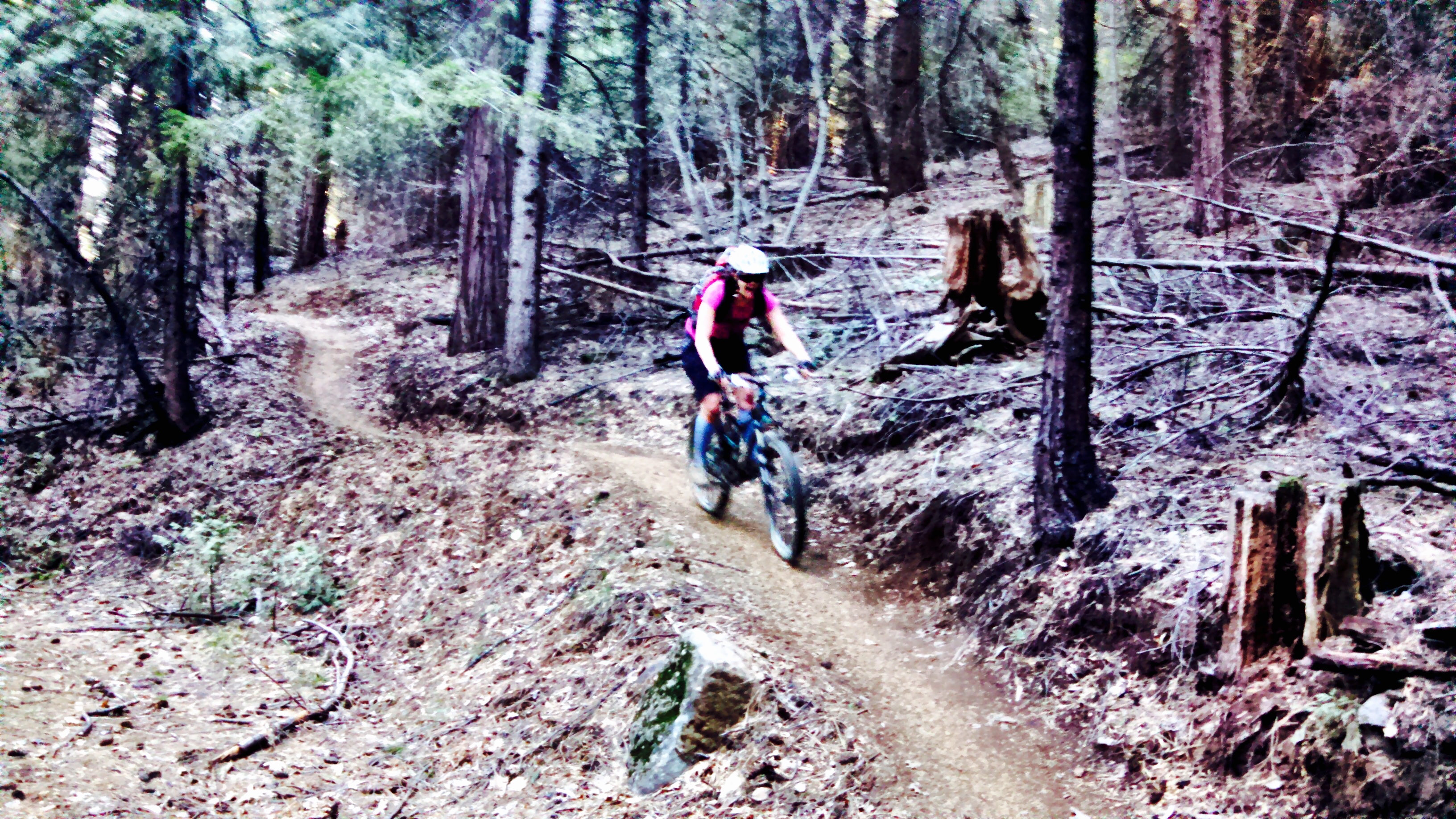
When one is presented with a less then optimal winter in the snow department, it’s time to squeeze those lemons and make some lemonade. Within 45 minutes of Truckee several great mountain biking trails are in tip top condition and ready to ride. So get out there and enjoy the dirt until the snow flies.

Photos courtesy of Kelly Conley
Heading down Highway 20
Drive 25 miles west on Interstate 80, and then take Highway 20 towards Nevada City. The next 22 miles you pass through a deep forest of conifers, briefly interrupted by several awesome viewpoints. The second one, Alpha Omega Vista has restrooms and a view of the eroded hillsides that are the still visible impacts of the Gold Rush. Five miles east of Nevada City you reach the Harmony Ridge Market on your right. Park in the Trail Parking lot, and decide on your trail option: Pioneer Trail or the Scotts Flat Trail.
The Pioneer Trail starts on the Harmony Market side and follows the highway back the way you came. It’s a lovely gentle climb for five miles, all rideable for just about any mountain biker. At five miles the trail crosses the road, and begins to get more challenging and steep. This is a good turn around point for many. Eventually it reaches all the way back to the Alpha Omega Rest Stop, which would be a fairly lengthy adventure.
The Scotts Flat Trail sits across the highway, and about one hundred yards uphill of the Market. This trail, recently constructed for mountain bikers, begins with a rolling jaunt at the top of the hill before heading down a long series of fun switchbacks to Scotts Flat Reservoir. Strong riders will have a blast and can turn around and ride back up, while others can follow the more gentle paved road to climb back to the start.

Photos courtesy of Kelly Conley
Peavine
Take the first McCarran Exit off Interstate 80 at the eastern edge of Reno. Head north past all of the commercial hubbub for a mile or two to Keystone, turn left. You will find trailhead on your right. A map of the extensive network of trails sits at the beginning of the ride, the trick will be remembering this map once you’ve been riding for awhile. It’s a high desert romp on popular trails, sometimes rocky, but mostly quite rideable, with beautiful views of the Reno metropolis and the high desert.

Photos courtesy of Kelly Conley
THINK OF ME, LYNN RICHARDSON, FOR ALL OF YOUR LAKE TAHOE AND TRUCKEE REAL ESTATE NEEDS!
lynnrichardson.net
Share this: Lynn Richardson, Your Friend in High Places
By Tim Hauserman
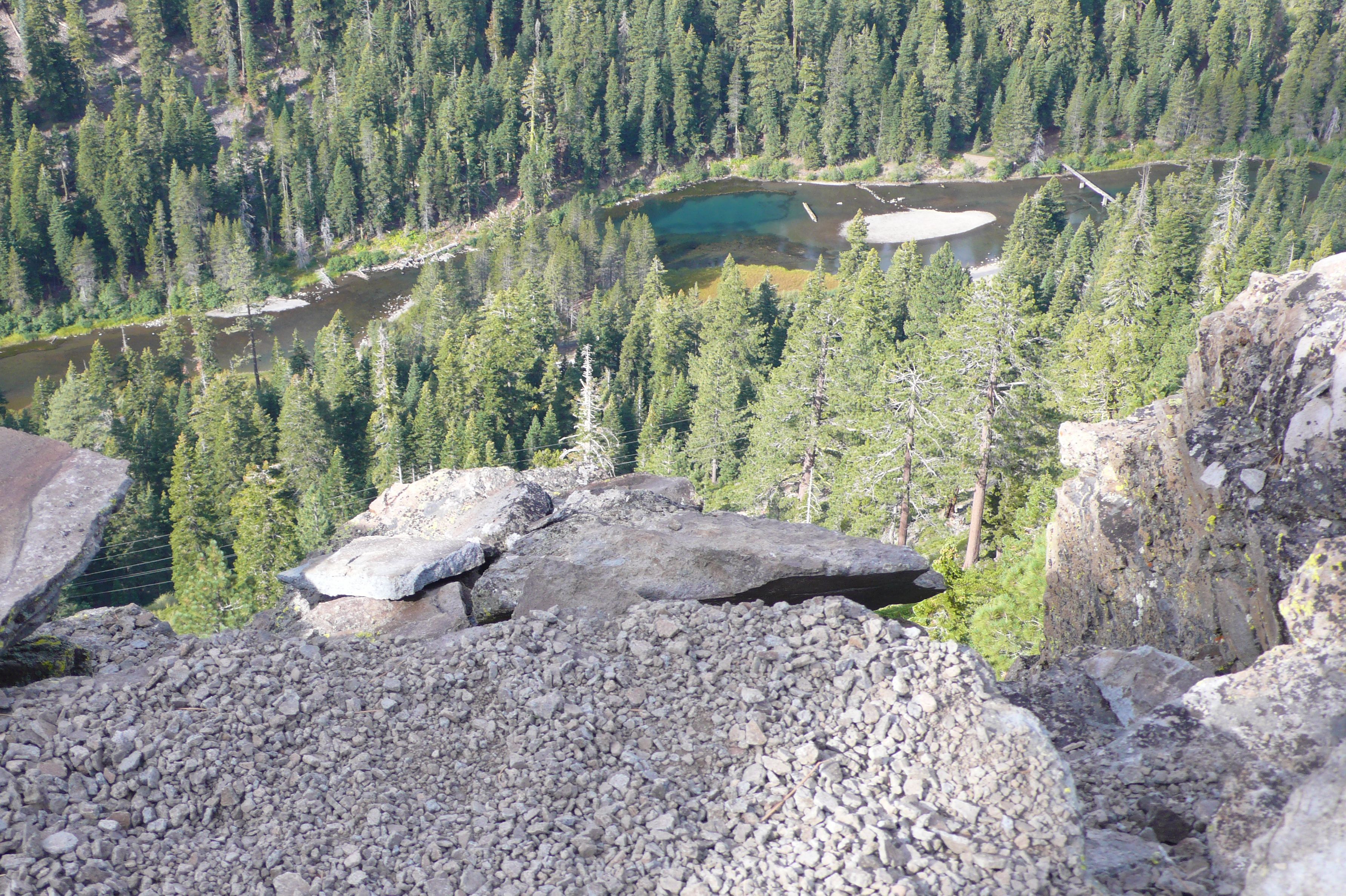
About five miles south of Tahoe City, just off Highway 89, sits Eagle Rock. Located just a stone’s throw from Blackwood Creek at the bottom of Blackwood Canyon folks have been congregating on the top of this rock for hundreds of years for a few simple reasons: it’s sits 200 feet above, yet very close to, Lake Tahoe; provides 360 degree panoramic views of the lake and Blackwood Canyon; and is easily accessible via a trail of less then a half mile. If you have a free hour, you can hike to the top, hang around and take a few photos and head back down with plenty of time to spare.

There are two trails to the top. One on the north side, and a newer trail constructed just to the south of the rock. Find parking along the road, or in a small dirt parking area on the south side. Both trails are well constructed and not very difficult. At the top, wonder around on the large gently sloped volcanic plug. You can catch views up Blackwood Canyon to the Sierra Crest and Twin Peaks, and then walk a bit further and capture incredible vistas of much of Lake Tahoe. The eastern edge of the rock, just above the highway, provides the most stunning lake views.
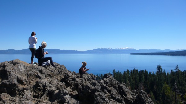
While this hike can be done quickly, bring a lunch and a good book, and you could have yourself a lovely and peaceful afternoon. Enjoy.
Tim Hauserman wrote the guidebook to the Tahoe rim trail as well as Gertrude’s Tahoe adventures in time,
THINK OF ME, LYNN RICHARDSON, FOR ALL OF YOUR LAKE TAHOE AND TRUCKEE REAL ESTATE NEEDS!
Share this: Lynn Richardson, Your Friend in High Places