Archive for the ‘Truckee’ Tag
By Tim Hauserman
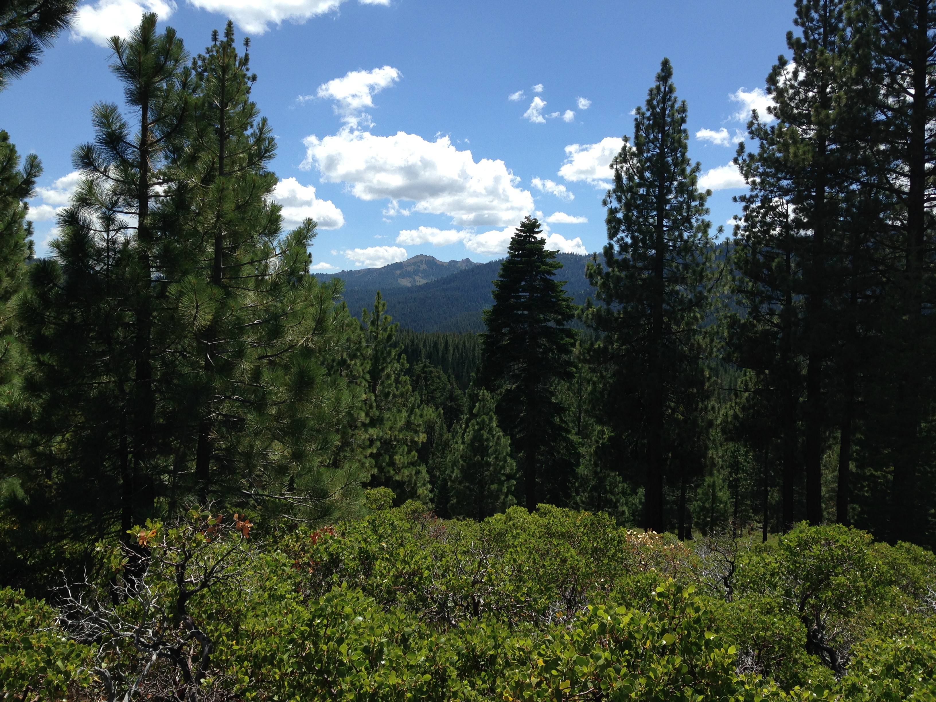
The Sawtooth is a trail built for mountain biking just a stone’s throw from the Sierra Meadows neighborhood south of Brockway Drive. I hadn’t ridden it in years when I made the good decision to give it another go recently.
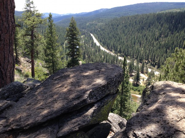
Sawtooth is a ten mile loop trail, which begins just off Forest Service Road 06. This major dirt road is part of the route for The Great Ski Race. If you were to keep following it south, you would eventually hit the Fiberboard Freeway near Watson Peak and Watson Lake. The Fiberboard is a Forest Service Road between Brockway Summit and Tahoe City, from which a host of popular single track trails spins off, including the Tahoe Rim Trail.
The Sawtooth trail is not difficult when it comes to the amount of ups and downs you will encounter, but most riders will find it challenging because of the rocky terrain and the numerous quick, sharp turns. The trick is to keep enough speed to make it over the rocks, while going slow enough to survive the hairpin turns. It’s a fun ride.

Fairly quickly, the trail makes it’s way over to the top of the Truckee River canyon, where a series of ridge top views of the Truckee River and Highway 89 await. Past the views the trail winds through Jeffrey pine and fir forest, with a thick understory of manzanita and ground hugging squaw carpet. You reach the southern most point on the trail at a crossing of FS 06. Now the trail becomes smoother, with fewer rocky sections and you have a chance to step on the pedals and get some speed going. You will also find a few decent climbs to get your heart pumping. The trail eventually hits FS 06 a second time and you are given an option: Cross the road and reconnect with a portion of the trail you have already ridden, back over a mile of rocky terrain to the trailhead, or roar down FS 06 back to your car. The entire loop should take the average rider about an hour and a half.
Trailhead: Drive through Sierra Meadows to Thelin. Follow it to the dirt and then find the trailhead on your right.
THINK OF ME, LYNN RICHARDSON, FOR ALL OF YOUR LAKE TAHOE AND TRUCKEE REAL ESTATE NEEDS!
www.lynnrichardson.net
Share this: Lynn Richardson, Your Friend in High Places
By Tim Hauserman

High Camp. Photo from Squaw Valley’s Facebook page.
Do you think that perhaps it might be time to drain the pool?
Hey we didn’t get a lot of snow last winter, and we’ve had a gloriously mild fall with an abundance of great hiking and mountain biking, so we don’t have to worry about getting our houses ready for winter, right? Ummm…wrong. In fact it was below freezing this morning as I write this and storms are definitely on the way. Here are a few things you need to do asap to protect your house and property:
Walk around the yard. What do you see? Are you Ok with everything you see being buried under the snow? Now’s the time to get those kayaks, canoes, and lawn furniture into storage or at least underneath a deck.
2) Landscaping system: Turn it off and drain the pipes. If the water remains in the pipes they might freeze and subsequently break. Do you have a hose still attached to the house? Disconnect and drain it.
3) Learn how to shut the water off to your house, and make sure if you are not there, instructions are provided for others. Some individual fixtures such as dishwashers, washers etc..have separate water shut off systems allowing you to shut it off to the fixture if there is a problem, and still have water in the rest of the house. If you have an older home without a shut off valve, have one installed by a plumber.
4) Cover the air vents leading to the crawl space below your house. This will help prevent pipes from freezing.
5) Open cabinet doors under sinks to get heat to piping. This is especially important with older homes.
6) Turn the heat on and keep the thermostat set above 50 degrees throughout the winter months. If you leave the house for an extended period of time, winterize the house by turning off the water and opening the faucets to drain all the water out of the pipes.
7) Prevent Bear Intrusions: Unfortunately, bears getting into homes in the area are now a year round concern. Close all window shades so bears cannot see your refrigerator. Remove any garbage from the house and garage and put it in the bear proof garbage container. If you are leaving for an extended time, remove smelly perishable food from the refrigerator. Be sure that all of the doors to your house are secure with strong hinges and deadbolt locks. Close the doors inside the house so that if the bear gets into part of the house, it will only focus on where the food is and not damage the rest of the house. Consider electric fencing designed for preventing bear intrusions, it has been proven to be very effective.
THINK OF ME, LYNN RICHARDSON, FOR ALL OF YOUR LAKE TAHOE AND TRUCKEE REAL ESTATE NEEDS!
Share this: Lynn Richardson, Your Friend in High Places
By Michelle Portesi
.
Here at ‘Your Friend In High Places’, the plan is to get all of our favorite hikes archived on the blog. There are many popular hikes in the area that are local favorites. Yet, with so much close access to the High Sierra back country, there are always new ones to discover.
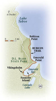
This post is focusing on The Rubicon Trail out of D.L. Bliss State Park on Tahoe’s West Shore. The California State Park and Campground is located on the lake side just before Emerald Bay. Day parking is $10 per car. If you frequent our state parks often during the year and don’t already have a membership pass, you might want to spring for one of the many day use options the California State Park Foundation has to offer that can really save you some money.

Along the Rubicon Trail, West Shore, Lake Tahoe (Photo by Michelle Portesi)
.
After turning into the park, drive all the way down to the bottom (You’ll be paying your fees at the campground kiosk near the day use beach and hiking parking lots.) There are bathrooms at the parking lot, so take the opportunity, as you will not see another bathroom until you get to the boat campground on Emerald Bay. While you can turn around at any time, if you want to make it to Emerald Bay, plan for this hike to take most of the day. This is a relatively easy to moderate hike, but I guarantee that you will be stopping to take many photos along the way.
The Rubicon Trail out of Bliss follows the lake for most of the way to Emerald Bay. You will be high above the lake for panoramic views, occasional glimpses of osprey and/or their nests and insanely vivid hues of blue waters. What makes this hike so amazing is the underwater geography of this particular part of the lake. Many millennia ago, part of the lake’s rim in this area sheered off down to the incredible depths below, creating sheer drop offs from the waters edge. In these areas, the color of the water stuns in deep shades of cobalt blue, as if someone had dropped many gallons of dye off Lake Tahoe’s shore. Further along the hike, shallow coves appear with white sand bottoms, in as many vivid shades of aqua as any exotic oceanic island.
.

Boating in cobalt waters, Lake Tahoe (Photo by Michelle Portesi – no photo color adjusting required…)
.
As you near Emerald Bay, there is a separate trail that veers to the left that will take you to the headland of the entrance to the bay. Here you will see the many boats on the lake that come for a glimpse of the bays many charms.
Back on the main trail that veers to the right, you are now down close to the shoreline. Many sandy beaches appear along the way. Continue on to the boat campground, thus named because most people boat in their camping gear for a stay instead of slogging it the long hike down. (Only park rangers and the camp host is allowed to drive down the fire road to the campsites.) From here you can view Fannette island in the middle of the bay, with the still visible remains of the stone tea house where the original owners used to ferry their guests for high tea in the afternoons. You can also see part of Eagle Falls in the distance.
If you’re feeling up to it, you can continue along the trail to the Vikingsholm Historic Site and the museum right next to it at the end of Emerald Bay. (Bring money with you if you want to do the tour through the estate). While you could theoretically hike back up to the highway from here, remember, your car is still at the base of Bliss State Park several miles away. Unless you’ve got some elaborate carpool plans going, most of us just turn around and hike the Rubicon trail back to our cars.
Congratulate yourself on getting a substantive amount of exercise. Now treat yourself to a margarita or an ice cold beer at one of the many West Shore establishments. You’ve earned it!
.

Rubicon Trail, Lake Tahoe
.

Share this: Lynn Richardson, Your Friend in High Places