Archive for the ‘Summer Recreation’ Category
.
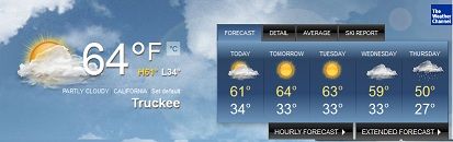
As summer winds down, Labor Day is usually considered the beginning of the Fall Season. I noticed as I went over Hwy. 267 that the aspens are already showing hints of turning yellow. We may be in for an early Indian Summer. Let’s hope it lasts for awhile.
But in the meantime, Summer isn’t done just YET! Go get out there and enjoy it. Before you know it, there will be white flurries in the air.
Be sure to check out our Events Calendar for Fun Happenings in the area.
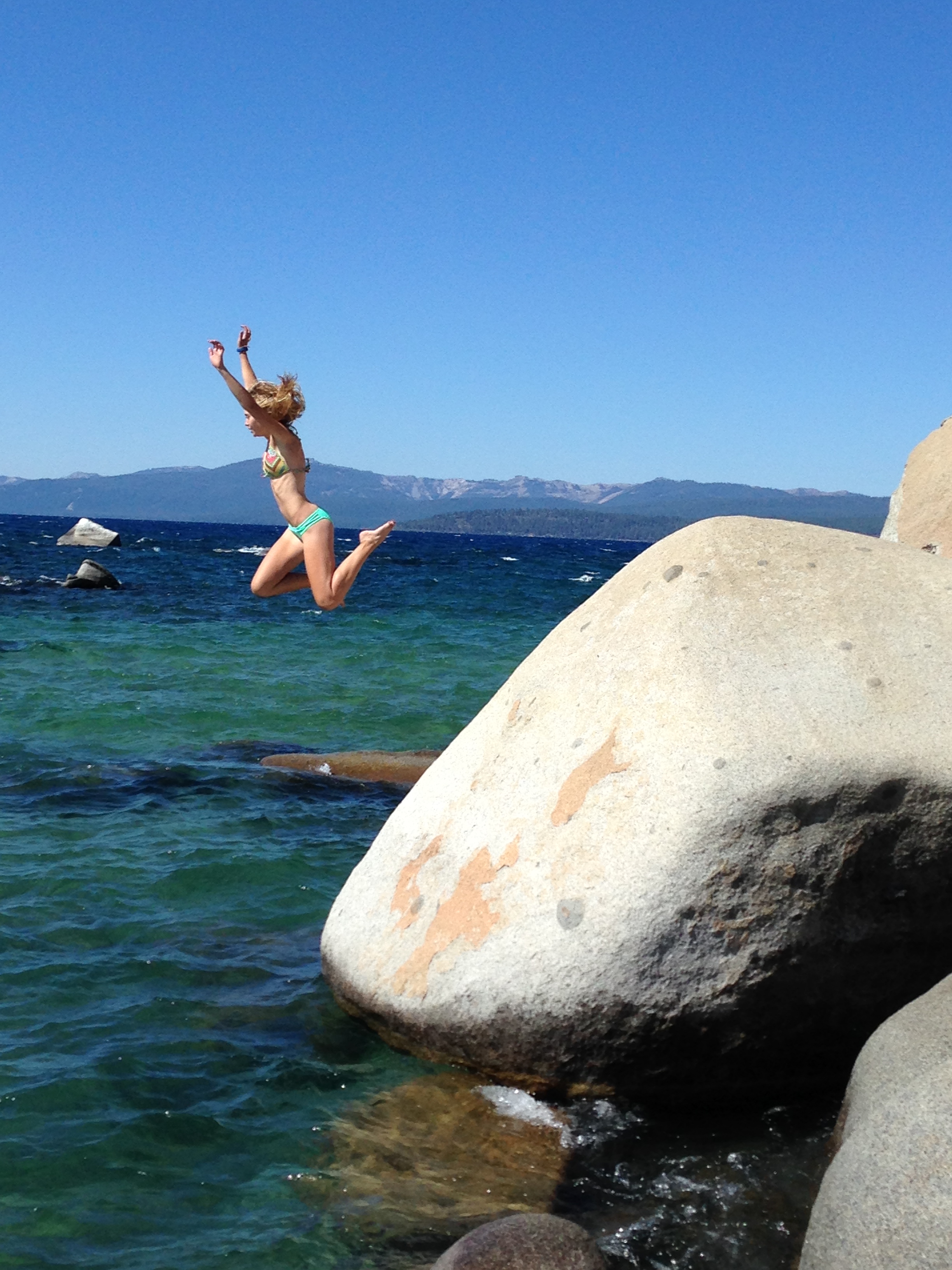
Summer is not over!! Never give in to September! It’ll be lovely through October!

Yes! That’s my kid!

Share this: Lynn Richardson, Your Friend in High Places
By Tim Hauserman
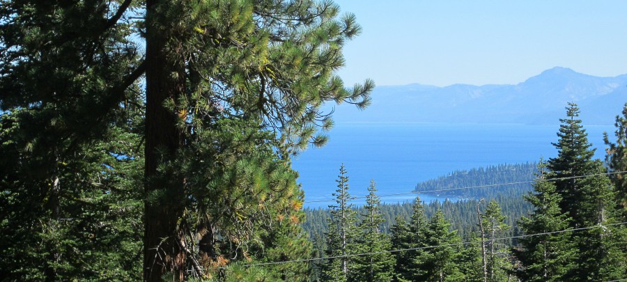
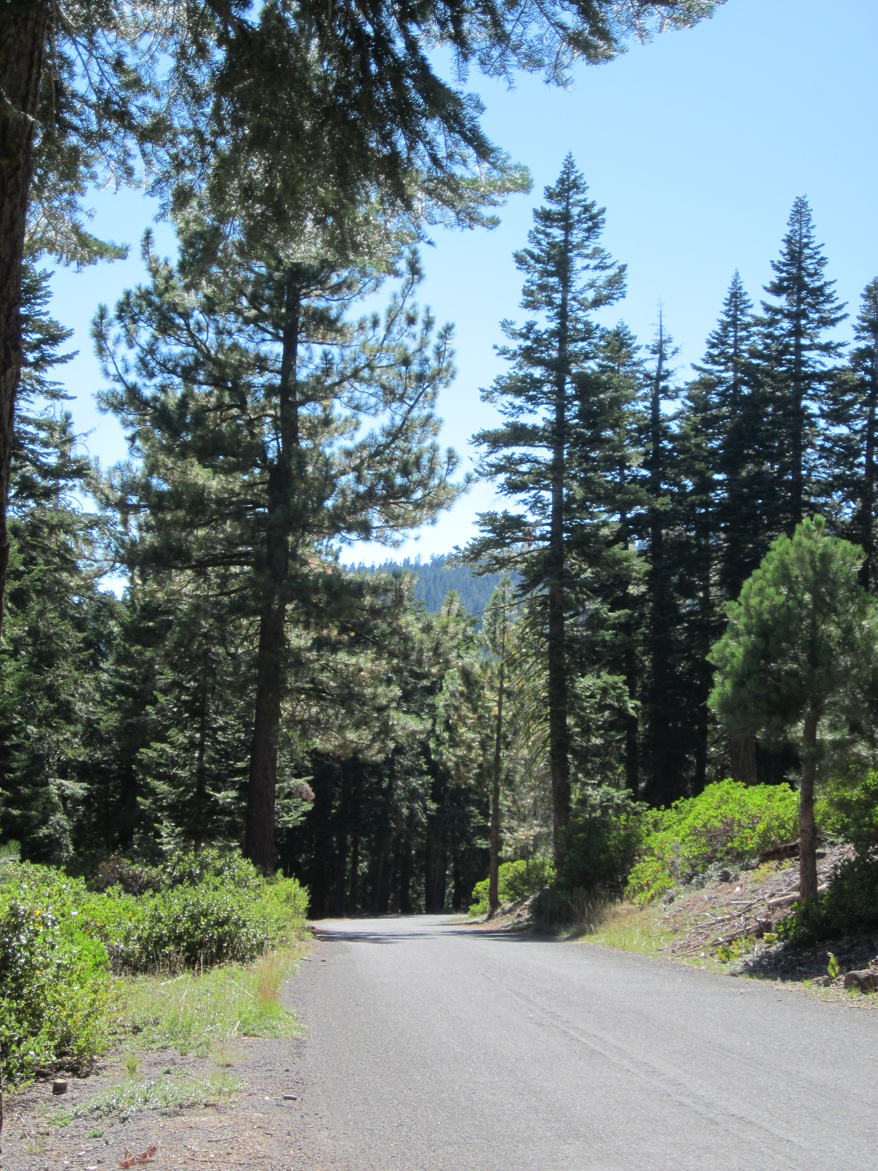
Scenic view high above Lake Tahoe along the Fiberboard Freeway
The Fiberboard Freeway winds through US Forest Service land between Highway 267 at Brockway Summit and Tahoe City. The name comes from the former owner of the property, the Fiberboard logging company. Freeway is a tongue in cheek phrase to refer to what is certainly the major road through the forest, but is by no means an actual freeway. Really, it means that much of it has pavement.
The Fiberboard Freeway is the main artery for mountain bikers to access the elaborate network of trails that include the Tahoe Rim Trail, Watson Lake and The Western States trails. You can start at Brockway Summit, or head up to the Fiberboard from Tahoe Cross-Country Ski Area outside of Tahoe City. While the dirt trails that head off from the Fiberboard are prime mountain biking terrain, the road can also serve as a very worthwhile road biking destination. The first 10 miles from Brockway Summit towards Tahoe City are paved, and very lightly traveled. So why not ride out and back and enjoy a road ride through the middle of the forest? I can’t think of a reason.
While it is just a 20 mile round trip, if you are looking for exercise, you can find enough on this route. There is not a lot of flat. The first six miles is a mostly uphill jaunt to the top of Starratt Pass, where you will find an offshoot trail to Watson Lake. Along the climb you will find frequent glimpses of Tahoe, cross the Tahoe Rim Trail twice, and pass some impressive trees and fields of mule ears.
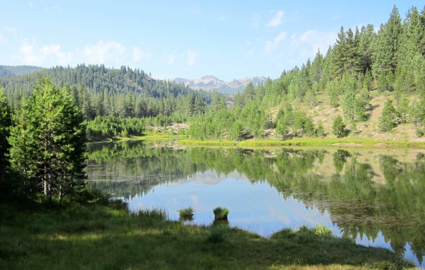
Then you begin a long and steady downhill, which eventually bottoms out before climbing again to a crossing of Stump Meadow, or what nordic skiers will know as the top of the Gold Trail. Just a bit further brings you to the end of the pavement and your turn around point.

Fiberboard Freeway
On the way back, Great Ski Race skiers will start to have flashbacks, as your ride back to the top of Starratt is the same route you would be skiing in the race. You decide whether skiing it or riding it is easier.
Words of caution: While the good news is that you are riding on pavement through the forest with almost no cars, rain and other cars have dragged gravel and dirt on the road in some spots. Take those downhills a little more cautiously then you would if you were on the smooth pavement.
Share this: Lynn Richardson, Your Friend in High Places
By Michelle Portesi
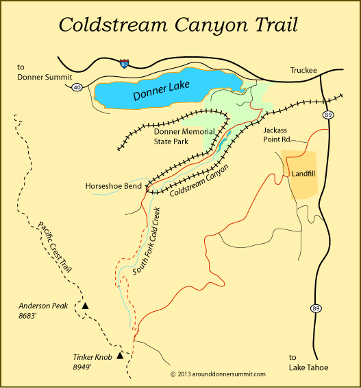
I’m embarrassed to admit this, but I’ve lived at Donner Lake off and on for years, and I’m just now discovering this hike…literally a mile from my home. That’s what’s so great about living here in the Sierra’s – no matter how long you’ve lived here, there is always something new to discover. Coldstream Canyon is actually considered part of the Donner Memorial State Park, with the entrance road literally hugging the campgrounds.
Located right off the I-80 freeway’s Donner Pass Road/Donner Lake exit on the east end of Donner Lake, go straight from the off ramp and drive to the end of the road, park your car and hike up along the creek. This is also a great area for mountain biking, cross country skiing and snowshoeing. The Truckee River Watershed Council has been working diligently to return this area to its original wetlands and has been an active steward of the creek area, as Cold Creek feeds into the Truckee River. It is still a railroad corridor, and there are plans for housing development in the lower section that was once a gravel quarry.
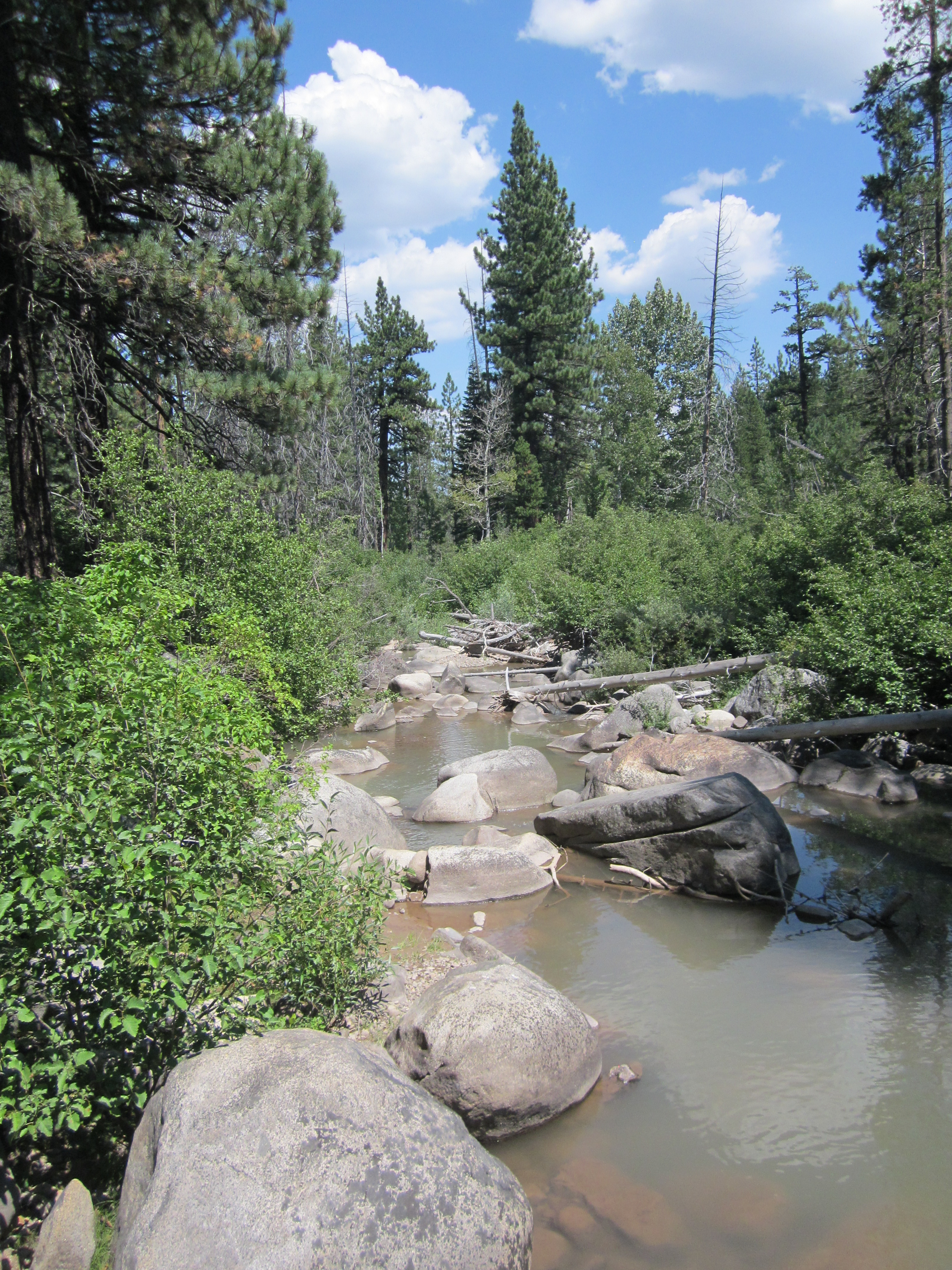
With so little snow last winter, I was surprised to see the creek still flowing with water. About a mile in you’ll reach meadows and marshland. I didn’t hike in as far as I would have liked this foray, but rumor has it that for a true back country experience, you can make your way to Lost Trail Lodge. It’s completely off the grid, but this is no Quonset hut. In the summer there is a jeep road that can take you all the way up if you have a 4 x 4 but you’ll have to park a 1/4 mile away from the lodge if you only have 2 wheel drive. In the winter however, you’ll be snowshoeing, cross country skiing or snowmobiling your way in and out.

Heavy rains just days before this picture was shot caused a landslide further upstream that made for some murky waters running through the creek. Photo by Michelle Portesi
You can read more about the history of Coldstream Canyon and the ongoing projects on the Truckee Watershed website. Be sure to check their calendar for upcoming events. There will be a River Talk this Thursday, August 21 at 8am and another in Tahoe City on August 25.
You can read an overview of the proposed development at Coldstream Canyon at the Tahoe Daily Tribune
For ongoing updates on the Coldstream Canyon Development, you can check in on the Town of Truckee website.
Share this: Lynn Richardson, Your Friend in High Places